Earthquake hazard 'demonstrably real' in CQ region
Published on 27 April, 2009
The Central Queensland region may seem to be less at risk from earthquakes in terms of population density, but the vital role of its economic infrastructure should also be taken into account.
That is according to CQUniversity seismologist Mike Turnbull, who said the region was under-resourced in terms of active earthquake fault identification services and calls for funding had 'fallen on deaf ears'.

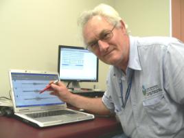
Mike Turnbull checks his measurements
Mr Turnbull, from the Central Queensland Seismology Research Group, said the CQ region was known to have a major complex of earthquake fault zones that had generated the 2 largest earthquakes to have occurred on the east coast of mainland Australia.
"Let us hypothesise that the SEQ region generated a magnitude 6.2 earthquake in 1918 and a magnitude 6.0 event in 1935," he said.
"There seems little doubt that scientists and engineers, and probably State and local governments and insurance industry bodies, would be falling over themselves in the clamour to identify where the active earthquake faults were situated - no matter what the cost; and political pressure from the general populous would demand such action.
"The recent experience of the central Italian magnitude 6.3 earthquake, with over 180 people killed and tens of thousands homeless and dislocated, not to mention the economic cost to lives, infrastructure and industry, gives us some idea of the effect a similar current event would have on south-eastern Queensland.
"Now let us change the location of this consideration to the Central Queensland region - to the area bounded by Maryborough in the south, Gladstone in the North, and west to Monto, Eidsvold and Gayndah.
"This is the same ground area as the south-eastern area previously considered - about 15,000 km2. However, there are some very important differences. The most significant difference is that the consideration is no longer hypothetical - the earthquake hazard is demonstrably real!"
Mr Turnbull said that, although this area only contained about 12% of the Queensland residential population (about 500,000 people) the Gladstone region alone currently generates some 27.4% of Queensland's and 7.6% of Australia's annual international exports by tonnage carried by sea.
"Current port trade is valued at greater than $5 thousand million per year and industry projects valued at up to $30 thousand million are planned over the next few years," he said.
"It is probably accurate to say that if the Central Queensland industrial revenue was disrupted for 6 months the Queensland government would be bankrupt."
Mr Turnbull said the 1918 'Great Queensland Earthquake' has often been listed in literature as a magnitude 6.2 (it is now listed in the Emergency Management Australia Database as magnitude 6.0, and in the Geoscience Australia Catalogue as a magnitude 6.0, but as recently as 2006 University of Queensland literature listed it as a magnitude 6.3).
The 1918 Gayndah Earthquake has often been listed in literature as a magnitude 6.0 (it is now listed in the Geoscience Australia Catalogue as a magnitude 5.5, but as recently as 2006 University of Queensland literature listed it as a magnitude 6.1).
Mr Turnbull said his own seismic monitoring from 2004 to 2008 provides more than 100 earthquake locations (ranging in magnitude up to 4.4) that are evidence of active major earthquake faults west of Bundaberg.
"Research I carried out in collaboration with staff from the University of Queensland indicates that this Central Queensland region can (and has) generate at least one magnitude 6.0 earthquake in any given 120 year period," he said.
"One particular fault line I've designated the St Agnes fault is an eastern extension of the fault zone that gave us the 1935 Gayndah event.
"This is just one of probably many active faults in the region. The Bundaberg off shore area that generated the 1918 earthquake has the potential to generate tsunamis inside the Great Barrier Reef, and continues to generate several earthquakes each year.
"Despite the economic importance of the region, and the demonstrated disastrous seismic potential of it, there is no clamour to identify and locate the active faults in this area.
"Indeed, attempts by CQUniversity to attract research funding to do so for the past 2 decades have fallen on deaf ears.
"This situation is bizarre and inexplicable given that the cost of doing so is miniscule compared to the national and State economic importance of the region."
Mr Turnbull said that, if a 3-year experiment to identify just those active faults to the west of Bundaberg were to be put in place it would cost about $300,000, or $100,000 per year.
"One tyre for a typical coal haul vehicle costs about $30,000, and one vehicle has 8 of them. It costs more than $240,000 just to shoe one vehicle each year! A little over one third of this amount would fund this basic seismic research each year; in relative industry terms this is almost an insignificant amount.
"Of course, it would be of engineering, social, and economic interest to identify more than just those few active faults. Certainly it would be desirable to identify those faults with the potential to adversely affect the large urban and industrial centres; however, it would seem good engineering and governmental sense to at least identify where the next magnitude 6.0 earthquake is likely to occur.
"It is not a clichéd matter of if this event will occur, but when and where."
Estimated Cost of a Three Year Experiment
|
Cost Item |
Estimated Cost |
|
10 temporary Seismic monitoring stations (less post-experiment value) |
$100,000 |
|
Communications links for 3 years |
$2000 |
|
Software |
$20,000 |
|
Part time staffing by one analyst/scientist (say 2 days per week for 3 years) |
$100,000 |
|
One 4WD vehicle (less disposal recovery) |
$30,000 |
|
Miscellaneous equipment, provisioning, and accommodation costs |
$48,000 |
|
Total |
$300,000 |

